

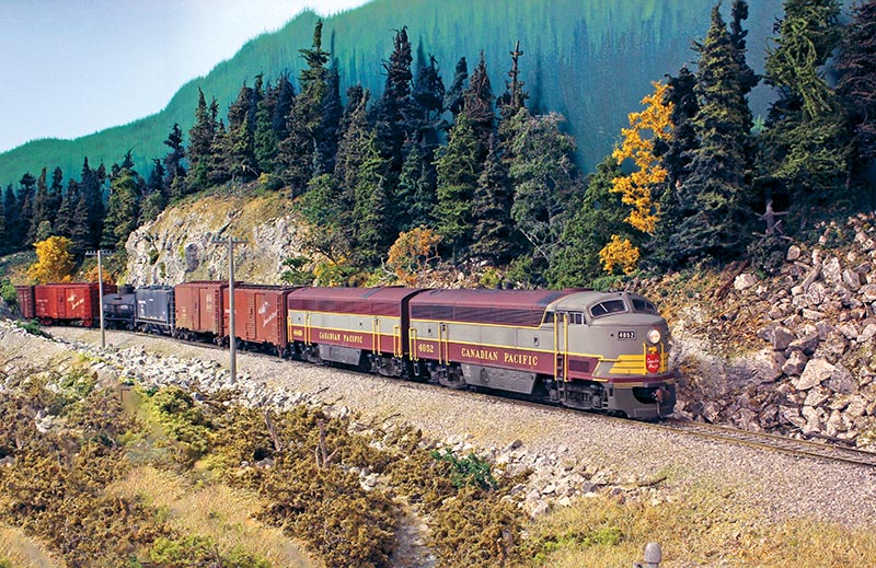
 by Scott Calvert/photos by Scott Calvert and Ken Catlin
Canadian Pacific’s Boundary Sub-division was once a busy mountain railroad crossing southern British Columbia between Nelson and Midway. Built during the mining boom of the late 19th century, the route climbed across a series of rugged mountain ranges to connect communities, mines, smelters, and agricultural districts with the larger CP system.
One of the most dramatic portions of the line crossed the Monashee Mountains west of Castlegar. Early switchbacks were replaced by the nearly 3,000-foot Bulldog Tunnel at Mile 50.4, while the train-order station at Farron, Mile 58.0, marked the summit. Farron included a wye, water tank, fuel facilities, section houses, and other maintenance buildings, and also served as a base for helper locomotives. From there, the railroad descended steep grades toward Christina Lake and Grand Forks through forested canyons and along mountainsides supported in places by masonry retaining walls.
Passenger service once included the eastbound Kettle Valley Express and westbound Kootenay Express, which covered the 126.6 miles between Nelson and Midway in about six hours. Steam-era trains typically used 2-8-2s and 2-8-0s, while CLC Fairbanks-Morse C-Liners and road switchers took over after dieselization in the 1950s. Budd RDCs replaced conventional passenger trains in 1958, with service ending in 1964.
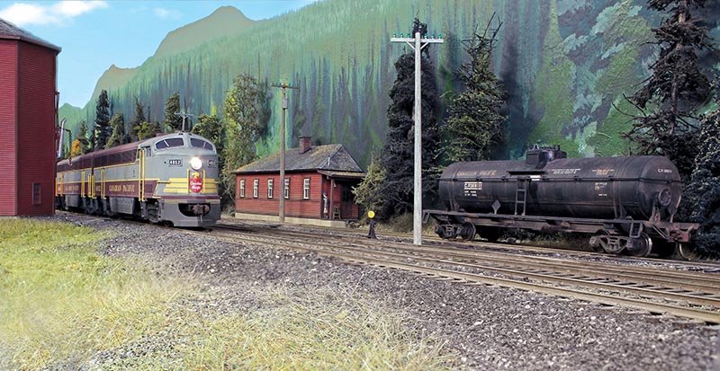
ABOVE: Extra 4052’s C-Liner set coasts to a stop beyond Farron station beside the 40,000-gallon water tank. After the steam era, CP retained several Kootenay water tanks for work trains and fire protection. CP fuel tank car 389111 was spotted on the fuel spur earlier by way freight Extra 8487, while the bunkhouse continues to serve work train and pusher crews.
Freight traffic increasingly centered on lumber, wood chips, and the Celgar pulp mill near Castlegar. As first-generation diesels disappeared, EMD GP38s became common on heavier trains serving Grand Forks and Midway. Declining traffic and the high cost of maintaining the mountain route eventually led to abandonment west of Castlegar in 1991.
For modelers, the Boundary Subdivision offers an appealing mix of steep grades, remote mountain scenery, helper operations, passenger service, and a wide variety of steam and diesel power. Farron Summit, in particular, captures much of what made the railroad distinctive.
Layout Expansion
A layout expansion in early 2019 required relocating the temporary west staging yard for the fourth time since 2015 when we hosted the first official Op session. This expansion extended the main line by 70 feet to the current 400 feet and included Farron. Two future expansions are planned to reach the ultimate length of 540 feet. We were excited to tackle Farron, in part because it was home for the pushers. The modeled Farron is 67 inches above the floor, making it the highest point on the layout, replicating the prototype.
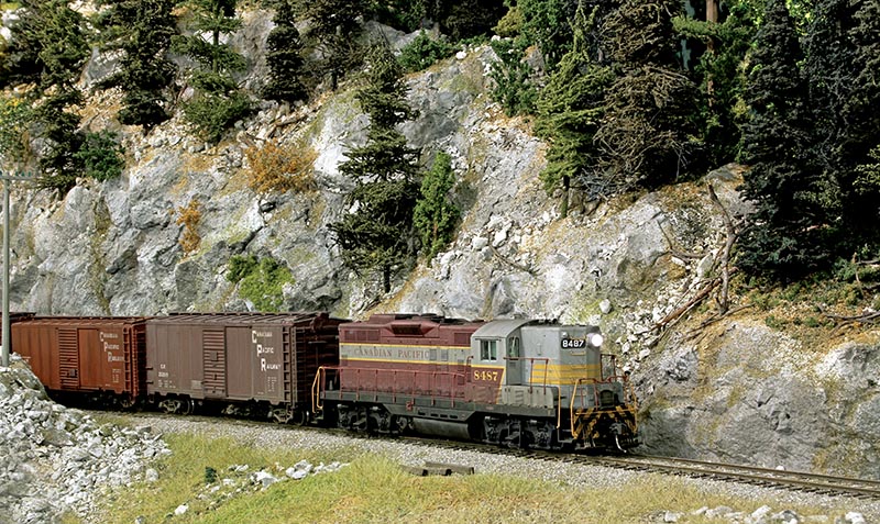
ABOVE: Way freight Extra 8487 emerges from the west portal of Paulson Tunnel and continues downgrade toward Grand Forks, where the crew will finish its work before returning to Nelson the following day.
The extension needed to be operational before hosting several operating sessions as part of the biennial VanRail operations event. Consequently, all efforts focused on completing roadbed, bus and feeder wiring, trackwork, turnout controls, added breakers on the DCC system, and, of course the requisite ops paperwork revisions created by this addition. Fortunately, there was sufficient time to also start some initial scenery along this new section, which added to the interest for our VanRail guests.
Once this section was integrated into the operations scheme for the layout, I faced the decision of whether to continue with the next expansion to the layout or complete the scenery on this current expansion. I had not yet done any finished scenery on this layout and was going through withdrawal. The last detailed scenery work I did was on my previous layout (see “CPR’s Boundary Subdivision” in June 2013 RMC). Because the Farron section is quite high, it created some photogenic “railfan” opportunities at locations such as the Paulson snow shed, the Paulson tunnel and the modest cluster of buildings at Farron.
Modeling with Drones
The prototype for this area was abandoned in 1991 and the rail grade became part of the Trans Canada Trail system. One unique aspect of the planning for this section of my layout was the use of a drone to take video and still shots of many of the areas modeled in this part of the layout. As a member of the trail society, I was able to obtain special permission to drive on the rail grade and use my drone. In return, some of the videos and still shots were used by the society.
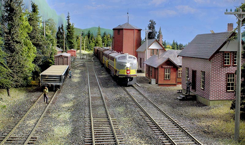
ABOVE: With the train order board down, Train 968 stops on the main to receive new orders. The crew will set retainers and take a mandatory break before beginning the descent down the east side of the pass.
Using a drone at any locations where members of the public are likely to be present must be done with a priority for safety and never flown when people were close by. One benefit of a drone is that it can provide images taken from the perspective of how we view our layouts. Another benefit is taking roughly horizontal images that can be used to guide the creation of backdrops for the scenes. Virtually all backdrops on the layout to date were painted by Rene Gourley using drone images for guidance.
Full Steam Ahead
The decision was made to proceed with the scenery and structures along this 65-foot-long U-shaped shelf. I was eager, although admittedly apprehensive, about attempting such a large and important scenic component of the layout since my skills were somewhat rusty. The benchwork is built from prefabricated plywood framing modules cantilevered from the walls due to being located directly above the divisional yard of Nelson and my modelling desk.
Concerned about messy scenery work happening directly above, a method was developed for creating high-density Styrofoam sculpted and shaped landforms which fit on each side of the roadbed. Ranging from 2 feet to over 4 feet in length, each landform was completely scenicked (other than the trees and foliage) in my workshop/garage. Once installed, the track was ballasted and final foliage, rock talus and miscellaneous details completed.
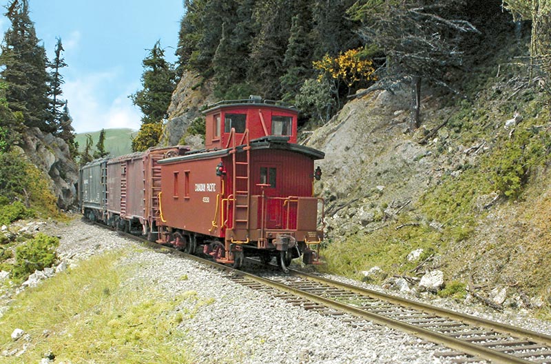
ABOVE: Train 968’s caboose rumbles through the deep rock cut, bringing a long and productive railfan trip along the rugged CP Boundary Subdivision to a close.
Trees were “planted” by simply poking holes into the Styrofoam and inserting the trees into them. Where trees are growing from rocky areas, holes were drilled into the plaster castings, finishing nails were inserted into them and the scenery was completed as noted above. Once the landforms were installed, the nails were pulled out and trees inserted into those holes. One major learning in this phase was a realization of how many trees were needed for the layout. We estimated that this completed stretch alone consumed over 600 trees…
